Radar
A world map of real fossil discoveries.
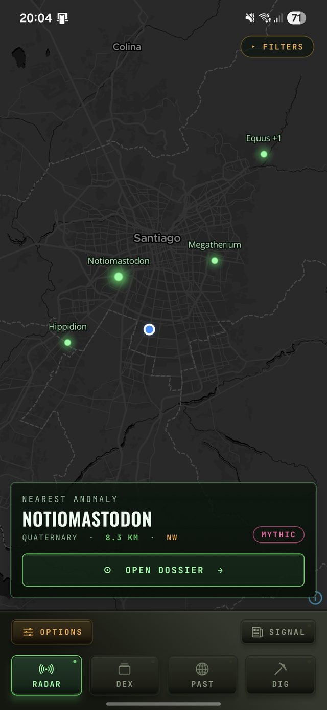
The Radar reads occurrence data from 1.8 million fossil records and puts them on a live map. Enable location and it tells you which prehistoric species have been found near you — with distance and bearing. Or pan anywhere on Earth and see what's been discovered there.
What it shows
Every point on the Radar is a real fossil locality from the Paleobiology Database — a documented occurrence with a species name, geological age, formation, and coordinates. The map covers all 74,000+ genera in the app across all 12 geological periods.
- GPS field mode. With location enabled, the Radar shows fossil sites near you sorted by distance, with direction. You can see how far you are from the nearest documented discovery.
- Global scan. No location required. Pan to any country, region, or continent and see the full fossil record there. Every major dig site on Earth is in the dataset.
- Smart clustering. Dense areas with many sites group into a single pin that expands as you zoom, so the map stays readable at any scale.
- Filters. Narrow the map by taxonomic group (dinosaurs, marine life, ancient flora, and more), geological era, or diet. Filters carry across the map and the Fossil-DEX catalogue.
The data behind it
The Radar is powered by the Paleobiology Database (PBDB), an open scientific repository of fossil occurrence records contributed by researchers worldwide. Each occurrence has a verified location, age range, and taxonomic identification. PaleoDex does not add, modify, or invent records — what you see on the map is what the scientific community has documented.
Radar vs. FossilRun
The Radar and FossilRun are two separate tools. The Radar is an exploration map — it shows where real fossils have been found, globally, using public scientific data. FossilRun is the dig game, which has its own always-on in-game detector for locating dig sites within a biome. The two don't interact: one is a reference map, the other is a game mechanic.